We value your privacy. This site uses two types of cookies:
strictly necessary cookies (session, login, shopping cart, and preference cookies required for the site to function — always on), and
analytics cookies (Google Analytics, used to understand how the site is used — only set if you accept).
We do not use advertising or marketing trackers. Learn more in our
Terms of Use and
Privacy Policy.
Hike Hampden
Explore the Trails of Hampden
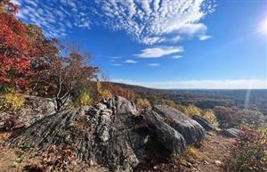
Discover the natural beauty of Hampden, Massachusetts, where scenic trails, peaceful woodlands, and rolling hills offer opportunities for hikers of all ages and experience levels. Whether you're looking for a relaxing walk through nature or a more challenging adventure, Hampden's trails provide a wonderful way to enjoy the outdoors, explore the local landscape, and experience the beauty of every season.
Minnechaug Land Trust Properties:
Minnechaug Land Trust is a local nonprofit organization dedicated to protecting important open spaces while supporting responsible growth and development in Hampden and Wilbraham.
Minnechaug Mountain Information and Trail Map
A 273-acre conservation area featuring approximately three miles of marked trails, ranging from gentle wooded paths to challenging climbs. The area offers scenic views and opportunities for hiking, birding, horseback riding, and cross-country skiing.
Trail access is available from the VFW on Main Street and the South Road parking area.
Goat Rock Information and Trail Map
A 35-acre conservation area featuring the Goat Rock Ridge Trail, which follows the Wilbraham Mountain ridge for just over one mile. Hikers can enjoy scenic views from Lookout Point and the historic Goat Rock.
Trail is accessible via the main park, Hampden Memorial Park on Main Street, or at the Gerrish Park side at the end of Country Club Drive, which goes up off Main Street a couple of hundred yards west of the VFW.
Rice Nature Preserve Information and Trail Map
A 150-acre conservation area in Wilbraham offering peaceful wooded trails and opportunities to enjoy nature and wildlife. The preserve connects with additional town-owned conservation land.
The public may use the Rice Nature Preserve for passive conservation and recreation purposes, subject to reasonable regulations by the Wilbraham Conservation Commission. Principal public access to the property is located at the main trailhead at the end of Highmoor Drive. Parking for eight cars is provided on the Highmoor Drive cul-de-sac.
Mount Vision Information and Trail Map
A scenic conservation area in Hampden offering wooded trails and opportunities for hiking, wildlife viewing, and enjoying peaceful views of the surrounding landscape.
Access the trail from North Rd. -Trailhead is adjacent to power lines. The main trail runs between North & Burleigh Rd. and is marked with white blazes.
Trails at Laughing Brook
See the inspiration behind author Thornton W. Burgess' tales. Laughing Brook Wildlife Sanctuary in Hampden is a peaceful, wooded nature preserve featuring approximately four miles of marked trails. The trails wind through forests, along Laughing Brook, and past ponds, wetlands, and natural features such as Split Rock. With routes ranging from gentle walks to more challenging sections, Laughing Brook offers opportunities for hiking, wildlife viewing, and enjoying nature in every season.
Trail is accessible via the entrance at Mass Audubon's Laughing Brook on Main Street in Hampden.